In the field
Smarty200 has successfully completed 70 dives since it was developed in 2022. We have demonstrated realtime processing of images using machine learning to feedback observations into vehicle navigation on the fly. Algorithms also generate content-aware summaries of large datasets so they can be sent over satellite bandwidths at the end of each mission, giving operators the ability to interact with large datasets without relying on vehicle recovery.
We have demonstrated the ability to search for, detect and track subsea communication cables by leveraging uncertain prior maps of cable routes and survey offshore infrastructure.
Cruises
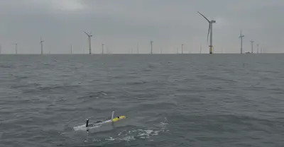
- KB26-01: Survey of Gwnt y Mor Offshore Wind Farm (PI Curtis/Simmons, June 2026).
- RK26-01: Survey of Brownsea Island off the dive support vessel the Rocket (PI Simmons, April 2026).
- TG25-01: Survey of Gwnt y Mor Offshore Wind Farm off the Thames Guardian (PI Curtis, October 2025).
- EE25-01: Survey of Cawsand Bay seafloor infrastructure off the Echo Explorer (PI Thornton, March 2025).
- EE24-01: Survey of Cawsand Bay seafloor infrastructure off the Echo Explorer (PI Thornton, November 2024).
- SS24-01: Survey of Cawsand Bay seafloor infrastructure off the Sound Surveyor (PI Thornton, April 2024).
- RK23-01: Survey of Studland Bay ecomoorings off the dive support vessel the Rocket (PI Thornton, September 2023).
- RK22-02: Survey of Studland Bay ecomoorings off the dive support vessel the Rocket (PI Massot, September 2022).
- RK22-01: Survey of Studland Bay ecomoorings off the dive support vessel the Rocket (PI Kaseem, July 2022).
Smarty200’s development was initially funded under EPSRC equipment grant (EP/V035975/1, 2021), in collaboration with the SMMI, IROE, Sonardyne and Voyis. It has since been deployed as part of EU H2020 TechOceanS (101000858, 2020-2024) and the Innovate UK OASIS project (10110715, 2024-2025) to demonstrate remote awareness of subsea surveys. In NERC Ecowind’s BOWIE project (NE/X008991/1, 2023-2027), the EU MaRITeC-X CMMI (857586, 2019-2026), it was used to survey offshore wind for both environmental impact assessment and technology transfer on critical infrastructure monitoring. It was also used to develop subsea cable monitoring technology under DASA’s ACC2037839, 2023-2025. Smarty200 will also support marine archeology through the RICHeS project, 2026-2030.